When searching for Destin, FL on the map, you’ll find a picturesque city nestled in the Florida Panhandle along the Gulf of Mexico. Known for its stunning white-sand beaches and emerald-green waters, Destin has transformed from a quaint fishing village into a premier tourist destination. Its strategic location offers both natural beauty and accessibility, making it a favorite among travelers.
Geographical Location
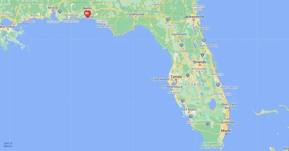
Destin is situated in Okaloosa County, Florida, on a peninsula separating the Gulf of Mexico from Choctawhatchee Bay. The city lies at approximately 30.3933° N latitude and 86.4958° W longitude. This unique positioning provides Destin with calm bay waters on one side and the open Gulf on the other, offering diverse aquatic experiences.
The peninsula was originally a barrier island but became connected to the mainland over time due to natural and man-made changes, including the construction of the Choctawhatchee-West Bay Canal in the 1940s.
Accessibility and Transportation
Destin is accessible via U.S. Highway 98, which runs east-west through the city. The Mid-Bay Bridge connects Destin to Niceville, providing a direct route over Choctawhatchee Bay. The city is approximately 48 miles east of Pensacola and 56 miles west of Panama City, making it a convenient destination for travelers.
For air travelers, the Destin-Fort Walton Beach Airport (VPS) is the nearest major airport, located about 16 miles northwest of Destin. This airport offers flights from various national carriers, facilitating easy access to the region.
Notable Attractions and Features
- Henderson Beach State Park: A protected area offering over 6,000 feet of scenic shoreline, nature trails, and camping facilities.
- Destin Harbor Boardwalk: A bustling area filled with shops, restaurants, and opportunities for water activities.
- Crab Island: A submerged sandbar near the Destin Bridge, popular for boating and social gatherings.
- Destin History & Fishing Museum: Showcases the city’s rich fishing heritage and evolution into a tourist hotspot.
FAQs
1. Where is Destin, Florida located on the map?
Destin is in the northwest region of Florida, in Okaloosa County, situated on a peninsula between the Gulf of Mexico and Choctawhatchee Bay.
2. What are the main transportation routes to Destin?
U.S. Highway 98 is the primary route through Destin. The Mid-Bay Bridge provides access from the north, and the Destin-Fort Walton Beach Airport serves air travelers.
3. What is Destin known for?
Destin is renowned for its white-sand beaches, emerald waters, and as a premier fishing destination, often referred to as “The World’s Luckiest Fishing Village.”
4. Are there state parks in Destin?
Yes, Henderson Beach State Park offers natural beauty, beach access, and recreational facilities.
5. How has Destin’s geography changed over time?
Originally a barrier island, Destin became connected to the mainland due to natural shifts and infrastructure developments like the Choctawhatchee-West Bay Canal.
Exploring Destin, FL on the map reveals more than just a location; it uncovers a vibrant community rich in history, natural beauty, and recreational opportunities. Whether you’re planning a visit or simply curious, Destin’s unique position on Florida’s Emerald Coast makes it a noteworthy destination.


